
I think we saw just about every type of feature possible in Colorado on our 197 mile motorcycle ride today from Gunnison to Durango. I took more than 150 photos and several videos to try and capture what I saw from my pillion seat on our BMW.
We left Gunnison at 8:30am and headed west on Route 50 into the Curecanti National Recreation Area, a series of three reservoirs along the Gunnison River.

The road sweeps around the reservoirs with views of high mesas and steep, craggy canyons. We turned off onto twisty and winding Colorado 92 at the 390' tall Blue Mesa Dam, the first dam completed on the Gunnison River in 1945. The turbines that provide hydroelectricity are remotely controlled from the Glen Canyon Dam in Page, Arizona.

Route 92 hugs the edges of the canyon to one side and rocky cliffs to the other, occasionally interspersed with meadows, hiking paths, and dirt ATV roads.

Route 92 continues on to the north, out of our way for today's trip. We turned around at an overlook and retraced our route back over the dam, and then continued on Route 50 west to Black Canyon of the Gunnison National Park. As we entered the park I thought that this really wasn't anything special: green fields with distant views of high mountain peaks. As we drove along the East Portal road, we saw a sign warning about 16% grades and tight turns, and the fun began.

The 2000' tall canyon walls drop at 90 degree angles to the Gunnison River that twists along the bottom of the canyon. We stopped at the lake created by the Crystal Dam and marveled at the Gunnison Tunnel, an 11' by 12' tunnel built between 1905 and 1909 that travels 6 miles from the Gunnison River to provide a reliable source of drinking water to communities in the valley.

We climbed out of the canyon and continued on Route 50 to Montrose, then south on Route 550 to Ouray where we ate lunch on the third floor outside deck of the Ouray Brewery.

Ouray is located in the San Juan mountains and bills itself as the Switzerland of the US. Originally settled by the Ute Indians, and named for the famous Chief Ouray, miners flocked to the area in the 1870's as part of the gold, silver and zinc mining boom. Unlike mining towns we've visited in Arizona where frequent fires destroyed blocks of buildings year after year, many of the original brick buildings in Ouray still survive.
Ouray is the jumping off point for the thrilling ride up and over the Red Mountain Pass on Route 550, known as the Million Dollar Highway through the Uncompahgre Gorge to the summit. Parts of the road were originally built by Otto Mears in 1883, a remarkable engineering feat in this steep, craggy canyon.
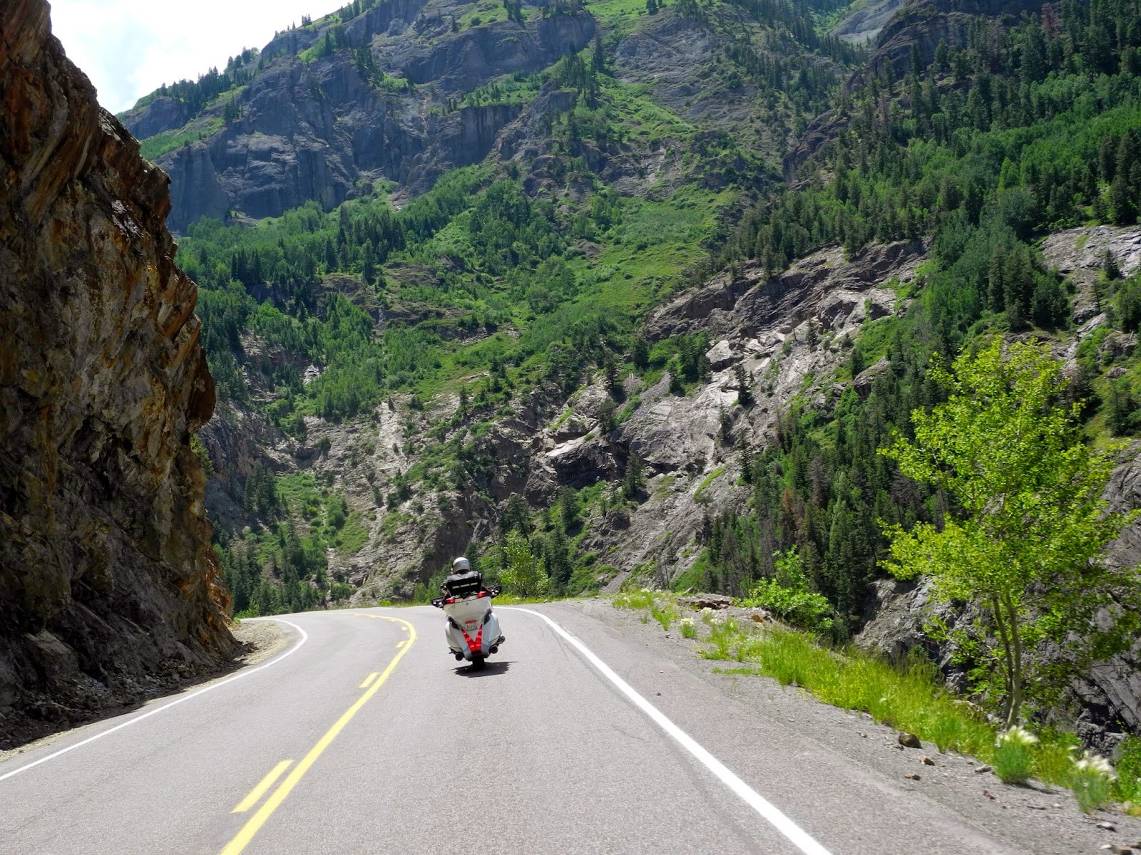
As we twisted and turned around the hairpin curves, we spotted the town of Ouray far below.

Red Mountain is actually a series of three rust-red peaks that get their name from the iron oxide in the rocks.

A few hairpin turns later we came to the viewing area at Bear Creek Falls, where Bear creek drops down to the canyon floor. Look closely and you'll spot hikers sitting next to the cliffs at the bottom of the Falls.

We continued winding our way up the 11,018' pass, passing twisted remains of more than 100 old mining operations along the way. The Idarado Mining Company has been conducting remediation projects in the area since the 1980's to divert water around the toxic tailing piles to keep the streams clear and clean.

It's amazing that this steep, narrow, and twisty pass is kept open all winter. The road reminded us of mountain passes in Europe: no guardrails, amazingly steep drop-offs from the road to the valley below, and tight hairpin turns.
Once we crested Red Mountain Pass, we had two more passes to cross - Coal Bank and Molas - before we dropped down into Silverton at 9,318' elevation. Silverton plays up its mining history with many original and restored buildings and an old-West ambiance.

We continued on Route 550 into Durango, a busy town on the Animas River where we walked through the historic downtown and watched the narrow gauge train steam in from Silverton. Tomorrow we head south toward home, leaving the green mountains of Colorado behind for the high desert of Arizona.
No comments:
Post a Comment